![](/images/other/stat-length.png)
![Tocht Te voet la Vall de Bianya - Hostalnou de Bianya-Sant Miquel del Mont - Photo](https://media.geolcdn.com/t/1900/400/af9a8c34-e2ee-4ee6-85cf-a01b10bc5c9d.jpeg&format=pjpeg&maxdim=2)
Hostalnou de Bianya-Sant Miquel del Mont
SityTrail - itinéraires balisés pédestres
Tous les sentiers balisés d’Europe GUIDE+
![Lengte](/images/other/stat-length.png)
![Max. hoogte](https://static1.geolcdn.com/siteimages/upload/files/1508320355ic_sort_altitude_max_24dp.png)
![Positief hoogteverschil](https://static1.geolcdn.com/siteimages/upload/files/1508320355ic_sort_den_pos_24dp.png)
![Km-Effort](/images/other/stat-length.png)
![Min. hoogte](https://static1.geolcdn.com/siteimages/upload/files/1508320355ic_sort_altitude_min_24dp.png)
![Negatief hoogteverschil](https://static1.geolcdn.com/siteimages/upload/files/1508320355ic_sort_den_neg_24dp.png)
![Boucle](https://static1.geolcdn.com/siteimages/upload/files/16400158638029165_repeat_loop_refresh_sync_direction_icon.png)
![Te voet](https://static1.geolcdn.com/sitytour/trail-icons/100.png)
3h11
Moeilijkheid : Gemakkelijk
![Scan deze QR-code om de tocht te openen in de SityTrail-applicatie](https://capi.geolives.com/qq0zvz2zws4bq2lad0pu/sitytour/trails/3110614/qr.png?size=200)
Gratisgps-wandelapplicatie
Over ons
Tocht Te voet van 8,2 km beschikbaar op Catalonië, Gerona, la Vall de Bianya. Deze tocht wordt voorgesteld door SityTrail - itinéraires balisés pédestres.
Beschrijving
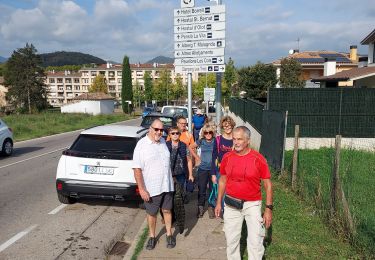
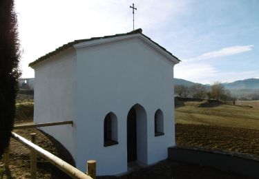
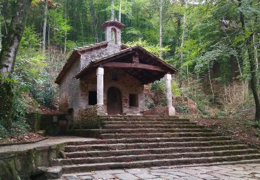
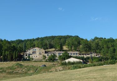
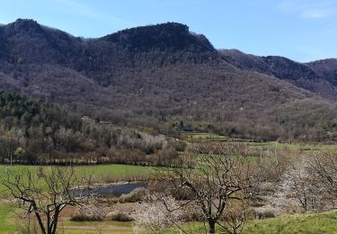
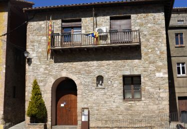
Breu introducció. Ruta per Hostalnou de Bianya( La Garrotxa), que arriba fins el cim de Sant Miquel del Mont, una atalaia esplèndida, amb unes vistes panoràmiques de l´Alta Garrotxa i del Pirineu. Abans podem gaudir d´una petita passejada per la magnífica Rourera de la Torre. Coneixerem també part del patrimoni arquitectònic com ara les esglésies…
Website: https://senderismegirona.org/2018/09/10/ruta-58-hostalnou-de-bianya-a-sant-miquel-del-mont/
Plaatsbepaling
Opmerkingen
Wandeltochten in de omgeving
![Tocht Te voet Olot - Vells camins de Batet - Photo](https://media.geolcdn.com/t/375/260/fee58355-adf9-4ae6-aee3-73244a38236a.jpeg&format=jpg&maxdim=2)
![Te voet Te voet](https://static1.geolcdn.com/sitytour/trail-icons/100.png)
Te voet
![](/images/other/stat-length.png)
![](https://static1.geolcdn.com/siteimages/upload/files/16400158638029165_repeat_loop_refresh_sync_direction_icon.png)
![Tocht Te voet Olot - Volcà Racó i Parc Nou - Photo](https://media.geolcdn.com/t/375/260/213d8610-59d2-4bef-9299-c2400a89efa1.jpeg&format=jpg&maxdim=2)
![Te voet Te voet](https://static1.geolcdn.com/sitytour/trail-icons/100.png)
Te voet
![](/images/other/stat-length.png)
![](https://static1.geolcdn.com/siteimages/upload/files/16400158638029165_repeat_loop_refresh_sync_direction_icon.png)
![Tocht Te voet Olot - Camins de Pedra Tosca - Photo](https://media.geolcdn.com/t/375/260/c5e4111a-b285-4599-900a-4bfdc81d391e.jpeg&format=jpg&maxdim=2)
![Te voet Te voet](https://static1.geolcdn.com/sitytour/trail-icons/100.png)
Te voet
![](/images/other/stat-length.png)
![](https://static1.geolcdn.com/siteimages/upload/files/16400158638029165_repeat_loop_refresh_sync_direction_icon.png)
![Tocht Te voet la Vall de Bianya - Via Romana del Capsacosta des del Pas dels Traginets - Photo](https://media.geolcdn.com/t/375/260/712e24c3-36c2-4569-84c8-5906de96abfc.jpeg&format=jpg&maxdim=2)
![Te voet Te voet](https://static1.geolcdn.com/sitytour/trail-icons/100.png)
Te voet
![](/images/other/stat-length.png)
![](https://static1.geolcdn.com/siteimages/upload/files/16400158638029165_repeat_loop_refresh_sync_direction_icon.png)
![Tocht Te voet Olot - Cuursa de la Moixina - Photo](https://media.geolcdn.com/t/375/260/d10c444b-4e4f-459e-bd54-f203b1c609f6.jpeg&format=jpg&maxdim=2)
![Te voet Te voet](https://static1.geolcdn.com/sitytour/trail-icons/100.png)
Te voet
![](/images/other/stat-length.png)
![](https://static1.geolcdn.com/siteimages/upload/files/16400158638029165_repeat_loop_refresh_sync_direction_icon.png)
![Tocht Te voet Olot - Camí dels Carlins - Photo](https://media.geolcdn.com/t/375/260/41a712f2-9290-4b2b-8d0f-bf0d1c78fea6.jpeg&format=jpg&maxdim=2)
![Te voet Te voet](https://static1.geolcdn.com/sitytour/trail-icons/100.png)
Te voet
![](/images/other/stat-length.png)
![](https://static1.geolcdn.com/siteimages/upload/files/16400158638029165_repeat_loop_refresh_sync_direction_icon.png)
![Tocht Stappen Olot - Olot j6 - Photo](https://media.geolcdn.com/t/375/260/a0e988ad-1e28-4b84-a73b-df8dcc909cd4.jpg&format=jpg&maxdim=2)
![Stappen Stappen](https://static1.geolcdn.com/sitytour/trail-icons/101.png)
![Tocht Stappen Olot - olot j1 - Photo](https://media.geolcdn.com/t/375/260/2022fac7-60d0-4649-aef8-8abff40305b3.jpg&format=jpg&maxdim=2)
![Stappen Stappen](https://static1.geolcdn.com/sitytour/trail-icons/101.png)
![Tocht Stappen Olot - OTW 2013 Espagne - Photo](https://media.geolcdn.com/t/375/260/ext.jpg?maxdim=2&url=https%3A%2F%2Fstatic1.geolcdn.com%2Fsiteimages%2Fupload%2Ffiles%2F1553511878bg_sport_marche.png)
![Stappen Stappen](https://static1.geolcdn.com/sitytour/trail-icons/101.png)